How Far Has the Upsala Glacier Retreated?
The Upsala Glacier's retreat in dated measurements: about 9 km since 1986 (Copernicus, 2023), 7.2 km from 1986 to 2014 (NASA), the 2008 to 2011 surge in retreat, the split from the Bertacchi glacier, and why the figures differ.
The Upsala Glacier has retreated around 9 km since 1986, on a Copernicus satellite image of 22 September 2023. NASA measured 7.2 km between 1986 and 2014, about 260 m a year. The retreat was not steady: the front was fairly stable from 2000 to 2008, then gave way, and in early 2019 its western tongue lost the point where it met the Bertacchi glacier and sped up again. Every figure below carries its period, because a retreat without dates says little.
The measurements
| Source | Period | What it found |
|---|---|---|
| APN study of Los Glaciares (c. 1997) | the three years before | The front retreating about 400 m a year; the arm practically blocked by icebergs |
| NASA Earth Observatory (2004) | late 1960s to mid-1990s | Some parts of the front retreated more than 4 km |
| Skvarca, Raup and De Angelis (2003) | 2000 to 2001 | Ice moving about 1,600 m a year near the front; calving at about 1,710 m a year at the western front |
| Sakakibara and others (2013) | 2000 to 2008 | 670 m of retreat |
| Sakakibara and others (2013) | January 2008 to May 2011 | 2,890 m of retreat, 880 m a year in 2008 to 2010 |
| Sakakibara and Sugiyama (2014) | 1984 to 2011 | More than 6 km, one of three fronts of the ice field to retreat that far |
| CONAE, Argentina’s space agency (January 2013 image) | the 30 years before | About 10 km |
| NASA Earth Observatory (October 2013 photograph) | against 2001 to 2009 images | About 3 km upstream; the front 2.7 km wide |
| NASA Scientific Visualization Studio (2014) | 1986 to 2014 | 7.2 km, about 260 m a year |
| Copernicus, European Union (September 2023 image) | 1986 to 2023 | Around 9 km; the Upsala and Bertacchi glaciers, joined in 2016, now separated |
| Lo Vecchio and others (2025) | January 2015 to January 2023 | 1,063 m at the western front, almost all of it after early 2019, up to 325 m a year |
Each figure as its source gives it; periods and the part of the front measured differ, so the rows are not meant to add up.
Why the numbers do not agree
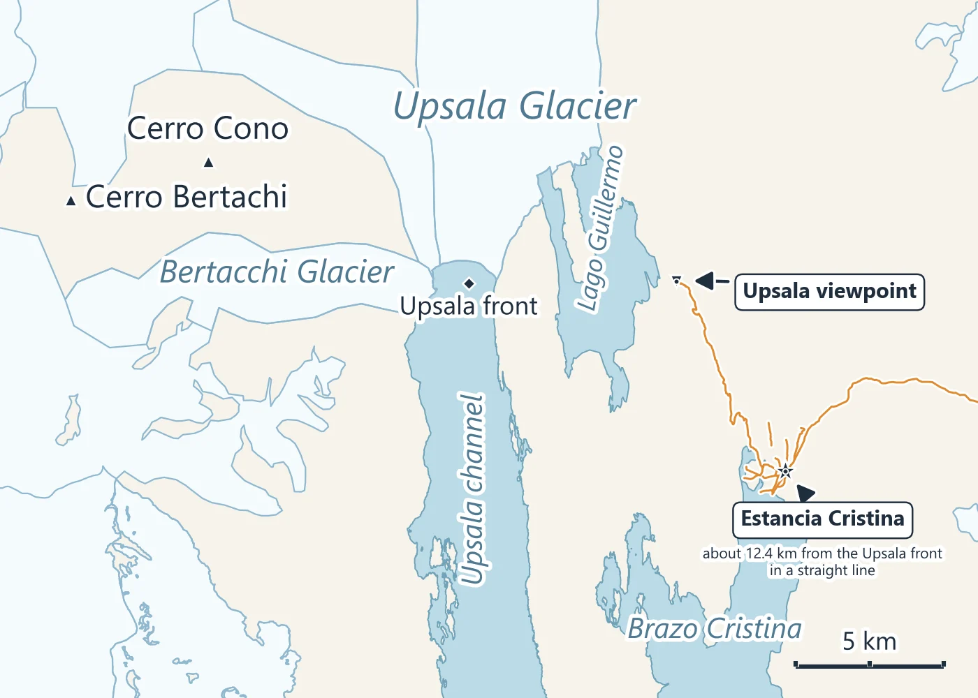
The studies start from different years (1984, 1986, the late 1960s), end in different years, and do not always measure the same part of the front: the glacier ends partly in the Upsala channel and partly in Lago Guillermo, and Lo Vecchio’s 1,063 m covers only the western tongue. So “10 km in 30 years” (CONAE, 2013) and “around 9 km since 1986” (Copernicus, 2023) can both be right for what each measured.
The sizes vary for the same reason, and because the glacier has shrunk: 595 km2 in an APN study of the 1990s, over 800 km2 for NASA in 2004, 840 km2 and 54 km long in 2011 for Sakakibara and colleagues, 785 km2 for the whole system with its tributaries in Argentina’s glacier inventory (from a 2005 image), and about 645 km2 in July 2022 for Lo Vecchio and colleagues.
Why it sped up
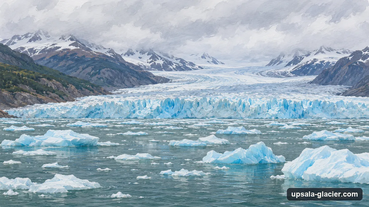
The Upsala ends in deep water: its western front calves into a channel about 600 m deep, and Argentina’s glacier inventory notes that the glacier’s base there lies below sea level. Alongside the 2008 to 2011 retreat, Sakakibara and colleagues measured the ice flowing 20 to 50% faster and the surface dropping by up to 39 m a year in 2006 to 2010. Lo Vecchio and colleagues found the western front almost still from 2015 to 2018, then retreating fast once it lost the pinning point where it met the Bertacchi glacier in early 2019. The park’s own management plan for 2019 to 2029 records retreat and thinning at the Upsala.
What it means for a visit
The boats do not go near the front: commercial navigation in the Upsala arm was restricted in 2016 and 2017 because the slopes along the channel were unstable, and can boats get close explains what the cruises do instead. The land lookout at Estancia Cristina looks over ground the glacier once covered; Estancia Cristina and the viewpoint describes it.
More from El Calafate
Glacier Days from El Calafate with Open Dates
Boat days, walkway tours and ice treks with live availability. What is included and the cancellation terms show before you book.

The Upsala Channel by Boat
Solo Patagonia's full-day cruise up the north arm and into the Upsala channel among the glacier's icebergs, with a landing at Base Spegazzini.
Check boat dates