Where Is the Upsala Glacier?
Where the Upsala Glacier is: at the head of the Upsala arm of Lago Argentino in Los Glaciares National Park, north-west of El Calafate. Its neighbours, its size by year, and how you reach it by boat or by land (November 2026).
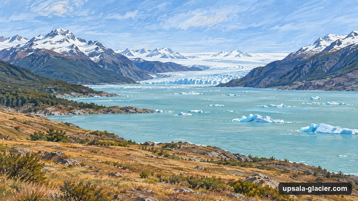
The Upsala Glacier is in Los Glaciares National Park in Argentine Patagonia, at the head of the Upsala arm, the far northern end of Lago Argentino, north-west of El Calafate. It flows out of the Southern Patagonian Ice Field and ends partly in the Upsala channel and partly in Lago Guillermo. No road reaches it: you get there by boat from Puerto Punta Bandera, 47 km from El Calafate by the national park’s figure, either on a cruise up its channel or on the boat to Estancia Cristina and its lookout.
On the map
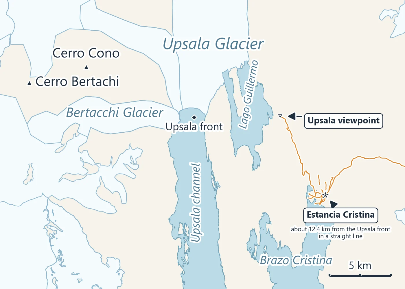
Lo Vecchio and colleagues (2025) place the glacier at 49.88 S, 73.28 W. On the park’s map Lago Argentino branches into arms; from the boat pier at Punta Bandera, Brazo Norte runs north-west, and the Upsala arm continues north from it to the glacier. Brazo Cristina, to the east, leads to Estancia Cristina. The Bertacchi glacier comes in from the west beside the Upsala’s front, and Lago Guillermo lies just east of it. Argentina’s glacier inventory names Cono, at 68 km2, as the largest glacier flowing into the Upsala.
How big it is
The answer depends on the year and on where each study drew the edge:
| Source | Year of the figure | Size |
|---|---|---|
| APN study of the park | 1990s | 595 km2 |
| NASA Earth Observatory | 2004 | Over 800 km2, the third largest glacier of the Southern Patagonian Ice Field |
| Argentina’s glacier inventory (IANIGLA) | 2005 image | 785 km2, the whole system with its tributaries |
| Sakakibara and others (2013) | 2011 | 840 km2 and 54 km long |
| Lo Vecchio and others (2025) | July 2022 | About 645 km2 |
Each figure as its source gives it, with the date it describes.
The park administration calls the Upsala the largest glacier in the park. Its western front calves into a channel about 600 m deep; Sakakibara and colleagues measured the ice cliff there at 51 m above the water on a 2010 model, and the front has moved since. How far it has retreated has the dated measurements.
The park and UNESCO
Los Glaciares National Park was created in 1937 and inscribed as a UNESCO World Heritage Site in 1981. UNESCO’s description names the Upsala, Onelli and Perito Moreno glaciers as the ones that calve into the milky waters of Lago Argentino, 160 km long.
Getting there
The town is the start: El Calafate to Puerto Punta Bandera is 47 km by provincial roads 11 and 8 (the park’s figure), about 48 km by road to the ferry terminal on our routing. From the pier there are two ways in:
- By boat up the channel. Solo Patagonia’s full-day cruise sails the north arm and up the Upsala channel among the icebergs, keeping well south of the front under the park’s navigation limit, then goes on to Spegazzini. Can boats get close? explains the limit.
- By boat to Estancia Cristina, then by land. The estancia’s boat crosses the north arm and the Cristina channel; a 4x4 and a 20-minute walk lead to the lookout. Estancia Cristina and the viewpoint describes the day.
Private boating is not allowed on the park’s arms (APN Resolution 13/2002), so these concession boats are the only way onto the water. The park fee, ARS 50,000 at the general rate from June 2026, is paid at the Punta Bandera gate or online.
More from El Calafate
Glacier Days from El Calafate with Open Dates
Boat days, walkway tours and ice treks with live availability. What is included and the cancellation terms show before you book.

The Way In: the Upsala Channel by Boat
Solo Patagonia's full-day cruise from Puerto Punta Bandera, up the north arm and into the Upsala channel among the glacier's icebergs.
Check boat dates